

History of the City of Campbelltown
The City of Campbelltown is a Local Government area located in Adelaide’s eastern suburbs. It is named after Charles James Fox Campbell, an early pastoralist whose restored homestead, Lochend, is recognised on the Register of the National Estate.
Campbelltown shares boundaries with the City of Tea Tree Gully, Adelaide Hills Council, the City of Burnside, the City of Norwood Payneham and St Peters, and the City of Port Adelaide Enfield.
The Council is divided into five wards.
Originally established as a District, Campbelltown became a Town with a dedicated Municipal Office on 1 January 1946 and was later proclaimed a City on 6 May 1960 after its population exceeded 15,000 (Leaney 1968).
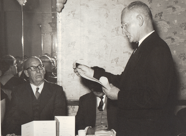
The City of Campbelltown comprises the suburbs of Campbelltown, Paradise, Athelstone, Newton, Hectorville, portions of Rostrevor, Tranmere, and portions of Magill.
Three waterways, Third, Fourth, and Fifth Creeks, run through the area and into the River Torrens. These creeks played a vital role in providing fresh water to the developing Adelaide settlement and offered early colonists a fertile and attractive landscape in which to establish their homes (Leaney 1968).
This area initially formed part of the East Torrens District Council, proclaimed in May 1853. The district stretched from the boundary of Adelaide into the Adelaide Hills, covering nearly half of the Hundred of Adelaide.
Its size and diverse interests soon created administrative challenges, and on 14 August 1856, boundary changes saw the Councils of Payneham and Burnside established.
Payneham was named after Samuel Payne, one of the original land subscribers in the colony of South Australia. Further boundary changes followed, and on 25 July 1867, the District Council of Stepney separated from Payneham.
In the following year on 16 December 1868, ratepayers from the eastern portion of the Payneham District met at the Paradise Bridge Hotel to discuss concerns that local rates were not being reinvested in their area, particularly for road construction and maintenance and 'to receive the report of the Committee appointed for the purpose of protecting the interests of the district and other business' (The Payneham District 1867).
At this meeting, Mr H. Silke recommended that the remaining portion of the district receive a new name and be divided into five wards: Hectorville, Campbelltown, Newton, Athelstone, and Woodforde and this was adopted. Mr J. Mitchell moved, and Mr Smith seconded, 'that the district be called Athelstone'. Mr J. D. Smith moved, and Mr Hill seconded, as an amendment, 'that the name be the Campbelltown District'. The amendment was carried by a large majority, along with the decision to retain the existing district boundaries (The Payneham District 1867).
Five days later, the inaugural Councillors representing the new wards were proclaimed:
- Hectorville Ward: Mr Thomas Gash
- Campbelltown Ward: Mr George Hill
- Newton Ward: Mr James Anderson
- Athelstone Ward: Mr Stephen Amber
- Woodforde Ward: Mr Alfred Walters (The Government Gazette 1867).
In its early years, meetings of the District Council were held in local hotels, including the Paradise Bridge Hotel, Reservoir Hotel, Thorndon Park, East Torrens Hotel and the Magill Hotel.
Council chambers
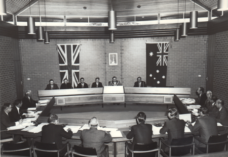
By 1891, plans were underway to establish a dedicated Council office and chambers. Land at the corner of Newton and Montacute Roads was purchased for £60, and with the support of local ratepayers, construction proceeded. The first Council Chambers and office opened in 1893. As the district grew, significant additions were made in 1936 to accommodate an expanding staff and a rapidly increasing population.
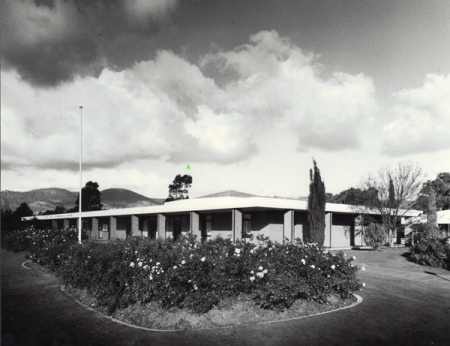
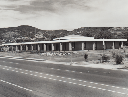
By the late 1960s, the City of Campbelltown planned to construct a new civic hall and administrative offices on land at the corner of Newton and Montacute Roads. However, rapid development in the area soon made it clear that the site was too small. Following extensive negotiations, Council acquired a larger parcel of land at 172 Montacute Road, Rostrevor, located approximately 200 yards east of St Bernards Road.
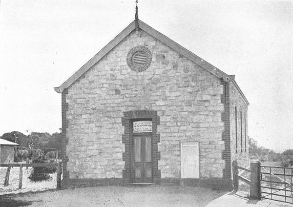
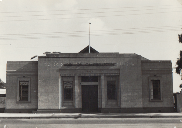
The proposal presented to ratepayers included a civic hall seating more than 1,000 people, a reception room, committee rooms, Council chambers and administrative offices. While the administrative components were supported, ratepayers did not endorse the inclusion of the civic hall and reception rooms, and these elements were removed from the final plan.
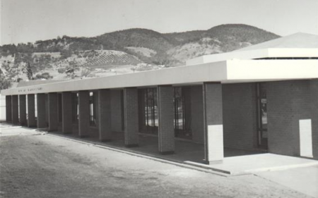
Construction was awarded to G. J. Rakauskas Pty Ltd of Vine Street, with building commencing in June 1967. The new design featured a distinctive hexagonal Council chamber with a raised roofline, and fair-faced brick walls.
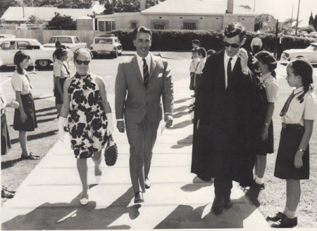
The new Campbelltown Council municipal building at 172 Montacute Road was officially opened by the then Premier Don Dunstan on Saturday 2 March 1968, exactly 100 years after the first meeting of the District Council of Campbelltown in 1868 (Leaney 1968).


Council pendant, emblem and logo
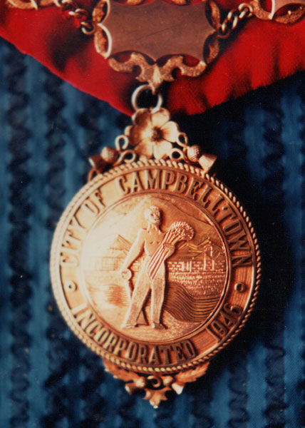
When Campbelltown was proclaimed a City in 1960, renowned jeweller A.W. Kenwrick was commissioned to create the pendant for the mayoral chain featuring a man carrying celery.
At that time, the district was known primarily for its extensive market gardens, particularly celery, which was widely regarded as the finest grown in Australia.
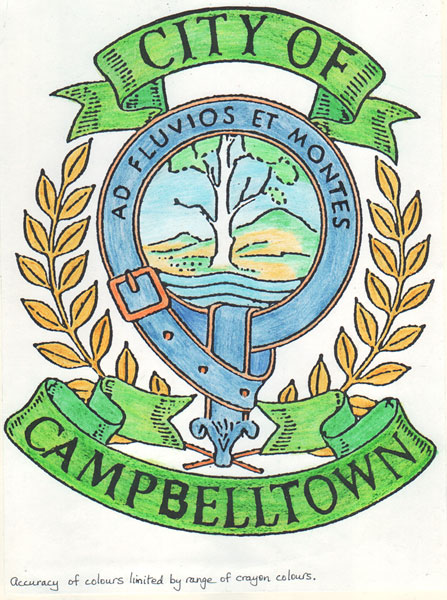
In 1961, John Dowie, a widely recognised artist and sculptor was commissioned to create the Campbelltown emblem. The emblem used today has a gum tree to reflect the area’s transition from agricultural land to a predominantly residential community and to highlight the region’s distinctive natural landscape.
The belt and buckle elements are drawn from the Campbell Scottish Clan crest, acknowledging the City’s namesake, Charles James Fox Campbell. Surrounding the emblem is a gold garland, with the words 'City of Campbelltown' engraved on an ornamental ribbon. Symbolically, the emblem represents Campbelltown’s position between the river and the hills.
On 26 February 1962, it was resolved by council that the colours blue, green and gold (derived from the Campbell tartan) would be the official colours of the City of Campbelltown (Leaney 1968). The Latin motto, 'ad fluvios et montes', translates as 'to rivers and mountains' (Campbelltown City Council n.d.).
In 1998, the City of Campbelltown held a competition to develop a new logo design. The winning entry, created by Kamina Couch, features yellow shapes symbolising both the sun and the letter C for Campbelltown.
The blue and green waves running through the centre represent the natural contours of the landscape, as well as the rivers and creeks that flow through the area (Campbelltown City Council n.d.).
Since that time, the logo has passed through two minor iterations, evolving alongside the community it represents.
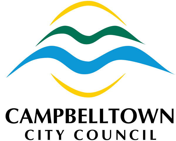
(superseded).
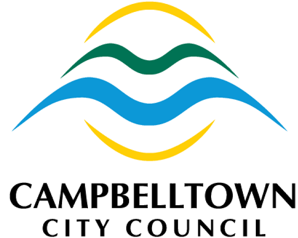
(superseded).
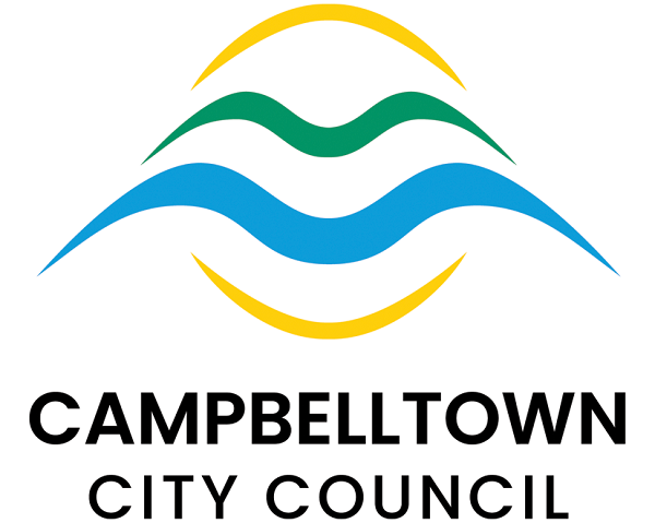
(current).
References
(1867) 'The Payneham District.', Adelaide Observer, 21 December, p. 2., accessed 2 December 2025.
(1867) 'The Government Gazette', South Australian Register. December 1867, p. 3, accessed 2 December 2025.
Campbelltown City Council (n.d.) Logo and Emblem, Campbelltown City Council website, accessed 2 December 2025.
Leaney J (1968) Campbelltown 1868-1968, The Corporation of the City of Campbelltown, Adelaide.